 West Kent Local News

1 / 2
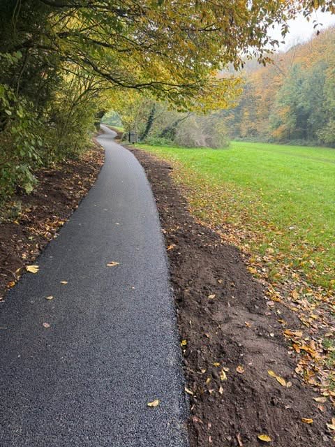
The newly resurfaced path through Taddington Valley. Image: Tonbridge and Malling Borough Council.
Taddington Valley's Robin Hood Lane to Kemp Close Path Resurfaced After Years of Complaints
A footpath through Taddington Valley, the 33-acre strip of ancient woodland between Walderslade and Blue Bell Hill, has reopened with a new tarmac surface after years in a state residents and councillors had complained about. The route between Robin Hood Lane and Kemp Close now has a 1.5-metre-wide surfaced path and accessible gates in place of the narrow, unsurfaced track that was there before.
View full interactive map → - the path runs through Taddington Valley between Robin Hood Lane and Kemp Close, Walderslade.
Taddington Valley sits astride the Tonbridge & Malling and Medway boundary and is owned and managed by Tonbridge & Malling Borough Council, despite its ME5 postcode and Chatham postal town. A remnant of the much larger Taddington Wood, it was historically coppiced for hornbeam, once used in gunpowder manufacture, and is still managed by coppicing today. The valley has thirteen separate entrances and exits and is heavily used as a cut-through by dog walkers and residents of the surrounding estates.
The condition of the path had been raised with the council before: a report to Tonbridge & Malling's Communities and Environment Scrutiny Select Committee in March 2026 cited Taddington Valley as an example of a route that was "almost impossible to walk safely" in winter weather. The borough council said the works were delivered in partnership with Kent County Council and Medway Council, reflecting the site's position on the boundary between the two authorities' areas.
Announcing the completed works, the council thanked residents for their patience during construction and said it hoped the improved surface would make the route more comfortable whether people were out for exercise, on the school run, or simply enjoying the valley's woodland and grassland.


